In the first half of 2018 I wrote my Master thesis, titled “Evaluating Arabia´s trade routes with Least-Cost path analysis”.
To give some historical background: trade routes operated by camel caravans on the Arabian Peninsula probably emerged shortly after the camel´s domestication in the late 2nd Millenium BC. This trade system reached its peak during the late 1st millennium BC and early 1st Millennium AD in the context of the aromatics trade. Most important trade good was incense. This aromatic resin was burned in temples and funaries of all religions in the ancient world from the Iberian Peninsula until Persia and beyond. The Romans even burned it in the streets to drown the stench of the sewers! The demand for incense was tremendous and the only supply came from the Dhofar and Hadramawt region in modern Yemen and Oman. Logically, whoever controlled the supply had enormous wealth and power. That´s why the Romans called the region of Southern Arabia “Arabia Felix” – the lucky Arabia. But not only the producers became rich with this trade. All along the trade routes settlements made their share by the means of taxation, selling protection, food, water and fresh camels and offering trade opportunities for the rich caravans. Settlements along the trade routes would flourish on this income and gain the upper hand against settlements that couldn’t. The course of the trade routes had a huge impact on all social and political structures of the whole region over centuries.
Naturally this observations form a Research question: how did the routes came together the way they did? Did the course somehow reflect the perception and decision of the people who took it and is it possible to identify these factors?
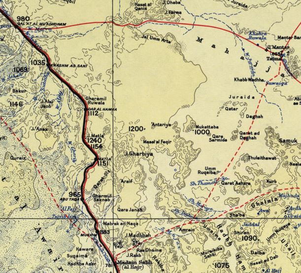
Study design: The study consisted of two parts: First, i had to understand where the routes exactly went. Luckily there is a number of sources on that topic. Roman and Greek scholars already described the trade and its organisation. This is no more than a list of cities but provides already a topology of the trade network. European Travellers of the 18th to 20th century gave a lot of information about the life and nature in Arabia when it was still mostly untouched by modern civilisation, almost unchanged since Millenia. Here, more detailed information could be gathered about the course of certain routes (e.g.: When travelling from city A to city B did they circumvent a certain mountain region or did they cross it?). Modern archaeological research on the organisation of trade and movement in ancient Arabia. This is of course the most reliable source since it follows scientific standards and is based only on sources contemporary to the topic.
Second, i compared the reconstructed routes with the hypothetically optimal routes for the same start-goal-combination. If both would be identical I could conclude that the caravan routes equalled the fastest route, hence cost efficiency was the prime and only influence for the formation of this route. If both would diverge it could be concluded that other factors influenced the formation stronger. Since my time and resources were limited i decided to limit the study area to the northern half of the incense trade route network, starting from Medinah (Saudi Arabia) and ending in Gaza (Palestine).
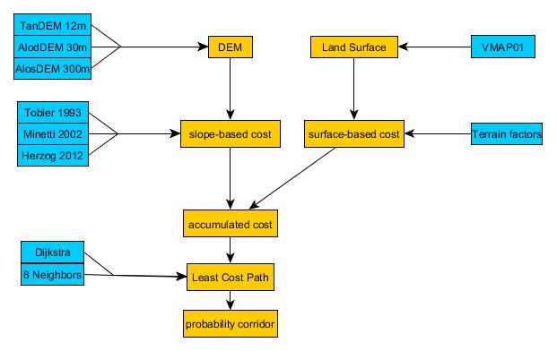
Method: To find the “optimal routes” i used the LCPA approach, which stands for Least-Cost Path analysis. In this approach a computer model is used to evaluate the energetic “costs” that accumulate when crossing a landscape. With such a quantification it is possible to calculate the path between two points with the lowest accumulated costs, the Least-Cost Path. It is an established method inside archaeology and outside but its implications need to be reflected and its implementation needs to be thought out.
To properly reflect the landscape of Arabia and its influence on movement i have designed a landscape model that not only resides on slope to model walking costs but also on terrain surface. After all, it is easier to walk on grass than on loose sand. To get a more realistic view on the movement options inside the landscape i have not only calculated a single optimal path but a raster of probability, on this raster it is possible to identify passage corridors. I have programmed the model myself and published to code on Github to give other researchers the possibility to revise my work or use it for themselves.
Results: After calculating all routes inside the study area and comparing them i stumbled across an interesting pattern: All routes related to what is called the “Incense route” are closely related to the LCP (Least-Cost path) while all other routes in the region deviate strongly from it. Take a look for yourself: map 1-6 refer to the “Incense route” while the rest does not.
Interpretation: Now, the “Incense route” is a 19th century scientific concept that states the reports from ancient geographers are to be taken literally and the incense trade was organised in one single route that did not change over centuries. Modern archaeological research rejects this idea and states that the climatic, social and political situation changes quite often. People needed the possibility to follow an alternative route. The incense trade route needs to be seen as a complex network of parallel-running, intersecting and redundant routes on which the traveller chooses the one that fits best to the daily circumstances.
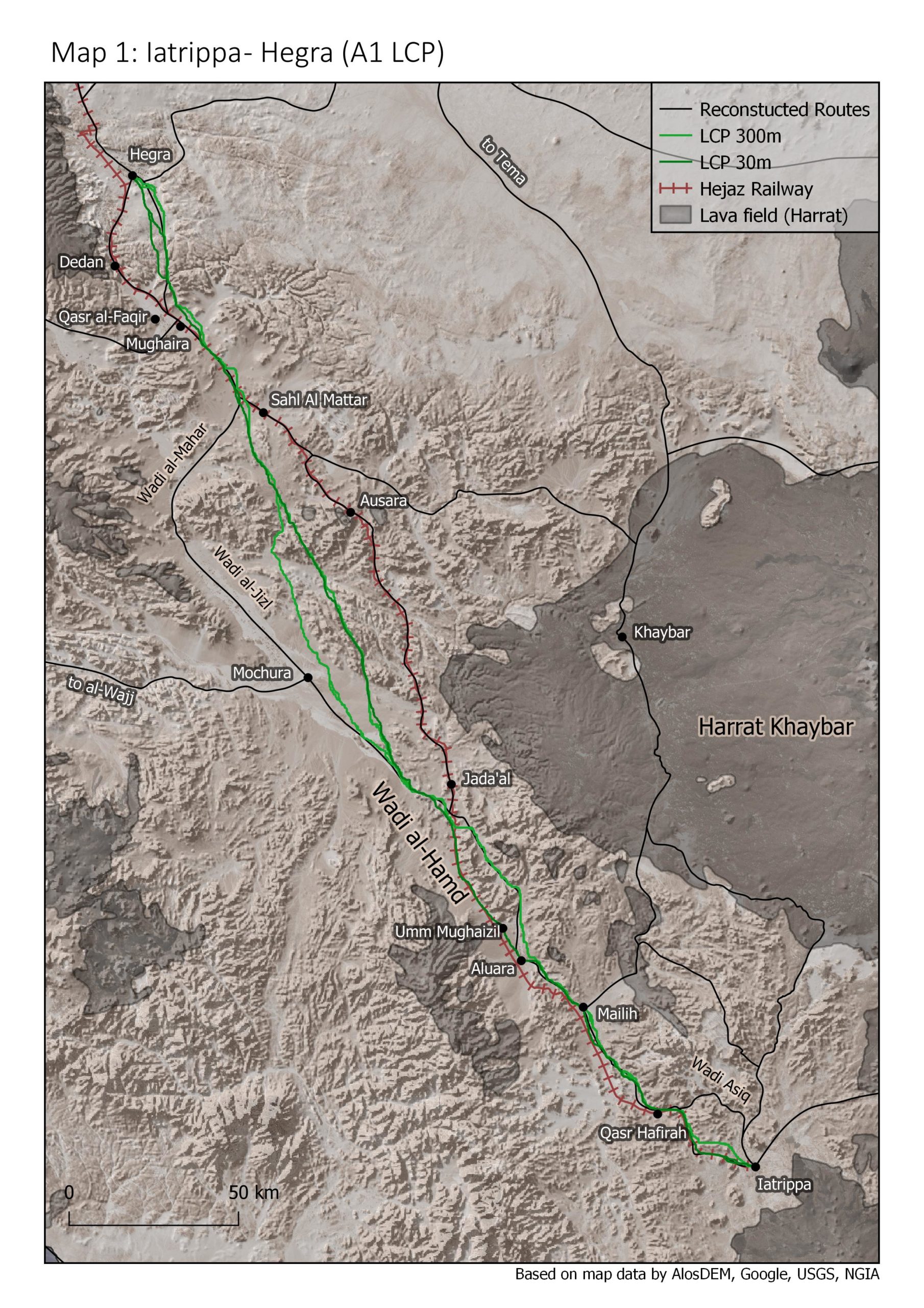
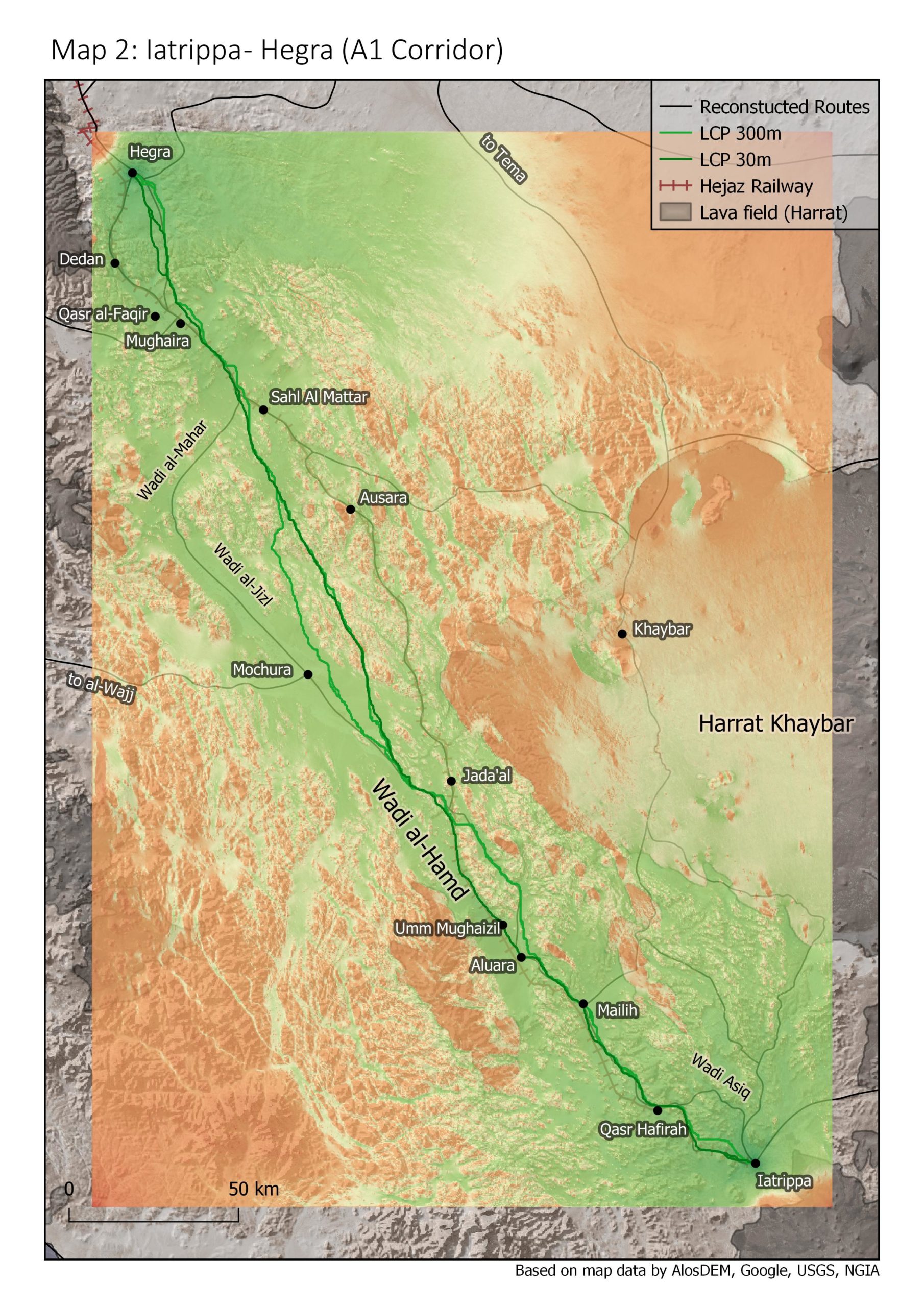
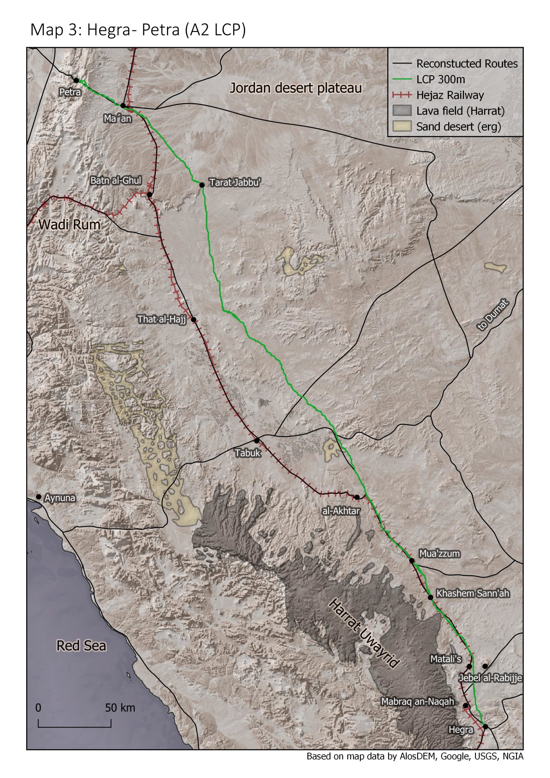
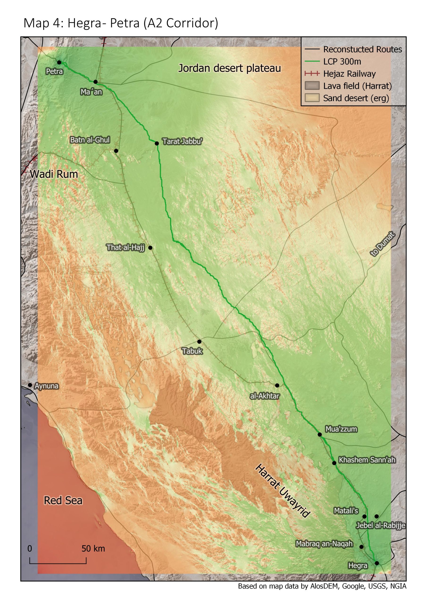
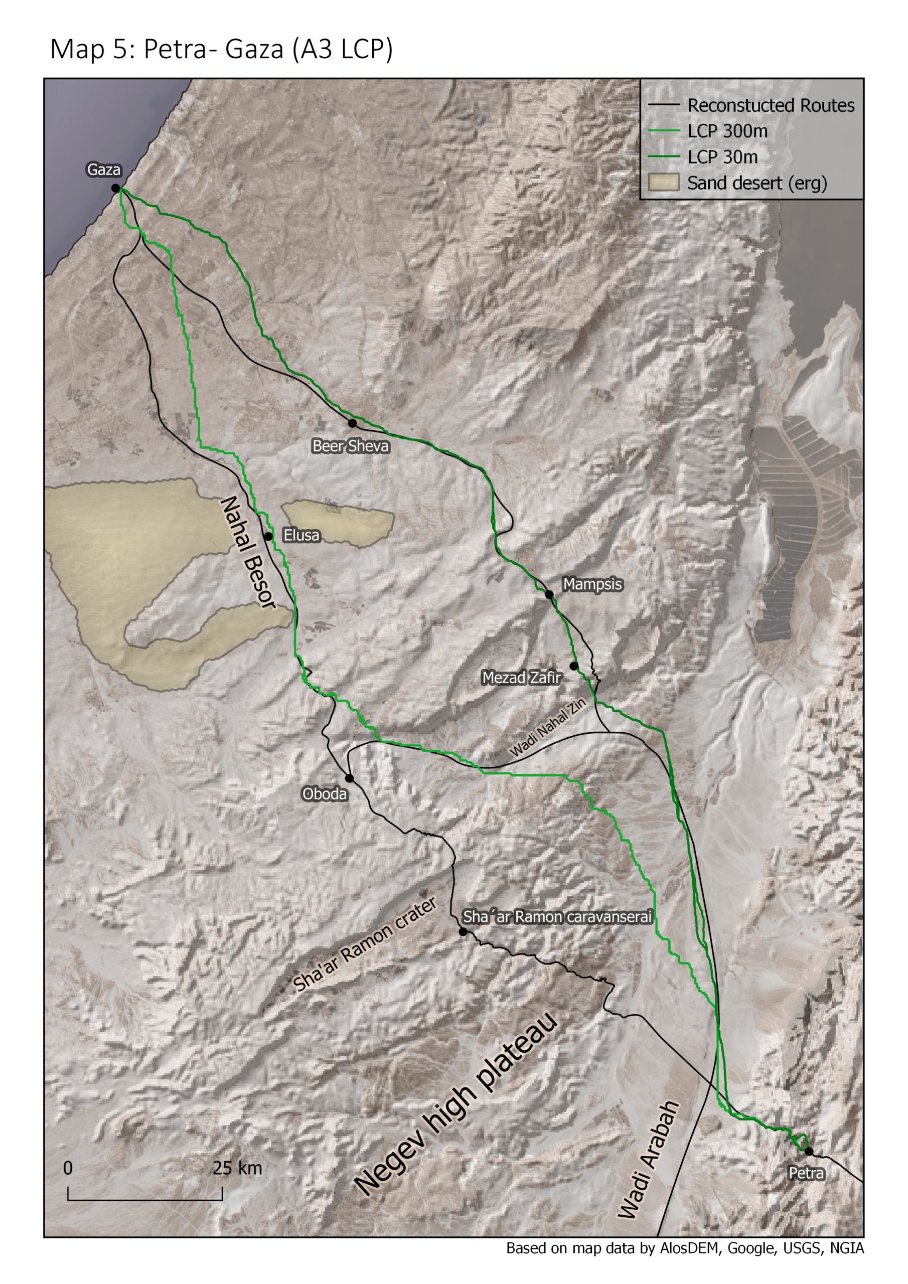
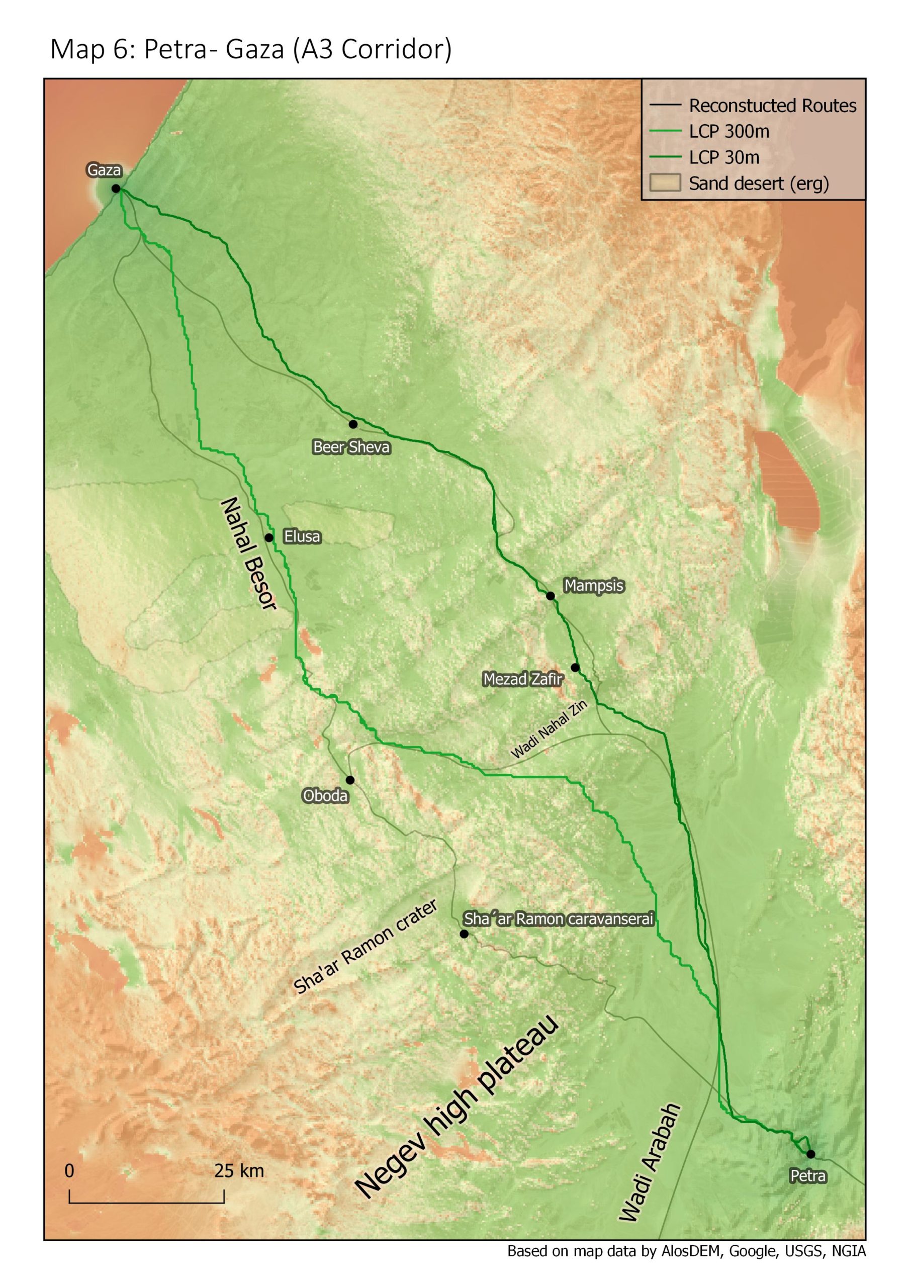
The observed pattern seems to suggest that the sections belonging to the “Incense route” were organised, maybe planned, in a different way than all others in this region. This could support the thesis that the Incense route actually existed. But there is a problem with the data: the pattern does not only correlate to the historical background of the route sections but also to landscape types: All routes that refer closely to the LCP lie in mountainous regions while the ones who don´t lie in open sandy plains. The pattern could be the result of an influence the landscape has on movement habits. For example, rain water accumulates in the Wadi valleys in mountainous regions, the density of springs and wells is higher, a caravan does not need to make a detour to get enough water supply. In open plains wells are much rarer and travellers on camel usually plan their journey from well to well to get enough water.
With the available data and inside the limits of the study it is not possible to answer if the correlation relates the landscape type or could actually be a proof for the existence of the incense route. Further research is needed which i intend to do in my PHD.
I have uploaded the data i gathered and calculated on this WebGIS so the interested visitor can browse around. You can zoom, move the map and click on single features to get detailed information.